Depth of Field: Photographing Alaska’s Changing Landscape
By Melba Lara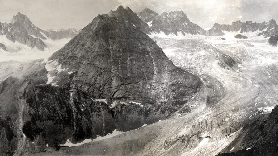
Depth of Field: Photographing Alaska’s Changing Landscape
By Melba LaraAs a botanist at Denali National Park in Alaska, Carl Roland has watched rising temperatures transform the landscapes he calls home. He’s tracked changing tree lines and watched the tundra dwindle. He’s grieved as wildlife habitats shrink when ecosystems respond to unexpected shifts.
In 2004, Roland stumbled upon a vast collection of landscape photos taken throughout the park’s history. He made it his mission to communicate the urgent need to address climate change by taking exact matches of more than 200 of the photos. The result is the Denali Repeat Photography Project, a lesson for us all about global warming’s impact on our natural environment. We spoke with Roland about his project.

This interview has been edited for brevity and clarity.
What makes Alaska a good model for this type of photography?
It’s ideal because there’s so little direct influence from people, in terms of changing the landscape, particularly in a park like Denali. So the changes we see are those that are naturally occurring and uninfluenced by development.
What kind of changes can you see in these photos?
You see a variety of changes, from changes in vegetation, shrinking of ponds and lakes across the landscape, of course, disappearance of glacial ice.
These photos show some breathtaking changes in glacial ice. Why are those so dramatic and worrisome?
It’s indicative of sea level rise, it’s indicative of transformation of water systems. If you take the glaciers in the Himalayas there’s large numbers of communities that will be dramatically affected by water once those glaciers go away, so individual manifestations of changes within our area represent very, very large scale fundamental changes on the planetary level.
Is there a specific photo that stands out to you?
There’s one photo we have of changing from a pond, back in 1975, to kind of a meadow and then to a variety of large shrubs and trees. And the impression this photo leaves is sort of football fans rushing the field after a game as you see these trees just marching across into this area that used to be basically a pond. For whatever reason that one really sticks in my mind because of how different the scene of the two images are.
For the most part, people understand the climate change is happening in Alaska, but what are the implications for the lower 48 states?
You’re already seeing the drought in California, you’re seeing the huge superstorms like Sandy on the East Coast, you’re seeing increased flooding along all coastal areas, including Florida. Again, it’s a fundamental transformation that will affect, at least in the next couple of decades, pretty much all of how people do business, I believe.
Click here to see the interactive “before-and-after” photos.
Melba Lara is the WBEZ’s host of All Things Considered.
![]()