Wings over Chicago, 1933
By John R. Schmidt

1
/ 2
1
/ 2
Wings over Chicago, 1933
By John R. Schmidt
WBEZ brings you fact-based news and information.
Sign up for our newsletters
to stay up to date on the stories that matter.
I enjoy flying into Chicago at night. The city is laid out before me like a giant Rand McNally map. The distinctive orange street lights pretty much define the city’s borders. The various expressways are easily identified, as are the major diagonal streets. It’s a fun way to pass the time while circling O’Hare.
So let’s take a plane trip over the Chicago of eighty years ago. If you were an airplane pilot, could you find your way around the city in 1933?
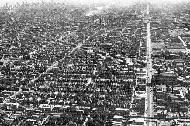
The idea is to determine the approximate location of the plane when this photo was taken. If you can identify the arterial street running up the right side, it shouldn’t be too difficult. But unlike the “Where in Chicago?” quizzes, I’m not going to tell you what section of the city this is.
Send is your guess as a comment. I’ll provide the answers in tomorrow’s post.